

Preserving Scenic Byways: How Communities Balance Roadway Access with Corridor Conservation
The Double-Edged Charm of America’s Scenic Byways
America”s scenic byways were created to make travel part of the destination. Routes winding through mountain passes, river valleys, forests, farmland, and historic communities invite motorists to slow down, appreciate distinctive landscapes, and spend time in nearby towns. For destinations across Tennessee and the wider Appalachian region, that experience can support lodging, restaurants, outfitters, attractions, and locally owned retail. Yet the same appeal that draws visitors can quickly place pressure on the corridor itself. A pastoral driving route can become a high-volume tourism artery, with congestion at overlooks, roadside litter, degraded shoulders, and emergency vehicles struggling to move through peak-season traffic.
The challenge is not whether communities should welcome driving tourists. The more useful question is how access can be managed as a shared civic and environmental responsibility. A scenic corridor management plan for Newfound Gap Road offers a relevant point of reference. The 31-mile route through Great Smoky Mountains National Park connects Tennessee and North Carolina and carries more than 5 million motorists annually, while also serving as a setting for natural, scenic, and historic interpretation. Its example demonstrates why modern planners must move beyond passive access. Successful byways require active stewardship that coordinates transportation operations, visitor services, ecological protection, and the economic interests of gateway communities.
Understanding the Operational Pressure on Gateway Communities
Tourism surges affect far more than the road segment that appears on a map. When visitors arrive in concentrated waves, nearby communities absorb demand for parking, fuel, restrooms, waste collection, cellular connectivity, public safety, and roadway maintenance. Local streets that were designed for residential circulation may become informal approach routes to trailheads, overlooks, or popular attractions. Businesses may benefit from increased foot traffic, but employees, residents, school buses, deliveries, and emergency responders must navigate the same constrained network.
These impacts are closely connected to housing and workforce patterns. A 2023 gateway community report describes how rapid visitation, amenity migration, and rising housing costs can produce longer commuter sheds and greater transportation costs for local workers. That finding matters for corridor managers because seasonal congestion is only one part of the operational picture. A community may face visitor traffic during the day, employee commuting pressure at shift changes, and delivery or construction movements at the same time. Effective planning therefore needs to connect tourism demand with land use, housing, mobility, and infrastructure decisions.
Peak traffic commonly produces a recognizable chain of problems. Vehicles spill onto shoulders when designated turnouts fill, repeated tire movements break down vegetation and accelerate erosion, and pedestrians cross unpredictably between parked cars and scenic viewpoints. Once roadside conditions deteriorate, maintenance crews often respond with repeated grading, gravel placement, or pavement repairs that treat symptoms rather than capacity. A corridor-wide approach should establish thresholds and response plans before the busiest weekends arrive.
- Track vehicle volumes, parking occupancy, pedestrian conflicts, incident response times, and shoulder damage by season and time of day.
- Identify locations where informal parking blocks sightlines, drainage, transit operations, or emergency access.
- Coordinate roadway, land-use, visitor-service, and business data instead of evaluating each segment in isolation.
- Set measurable carrying-capacity triggers that activate shuttle service, parking controls, public messaging, or temporary traffic adjustments.
Carrying capacity should not be understood as a single number that permanently limits visitation. It is a management tool that helps officials distinguish between acceptable use and conditions that damage resources or diminish the visitor experience. A corridor may accommodate high traffic at one overlook and very little traffic at another because of differences in geometry, habitat sensitivity, restrooms, or pedestrian safety. Planning around these variations allows communities to protect vulnerable locations without unnecessarily restricting the entire route.
Engineering Wildlife Connectivity and Habitat Buffers Along Paved Roads
Roads divide habitat into smaller, less connected areas. For wildlife, the consequences include disrupted migration, reduced access to food and water, vehicle collisions, and increased exposure to fences, development, and other barriers. The U.S. Fish and Wildlife Service explains wildlife corridors as routes that animals use to complete their life cycles, ranging from local river systems to continent-scale movement pathways. Scenic roads often pass through precisely the landscapes where these connections are most important, including mountain forests, wetlands, grasslands, and riparian corridors.
Connectivity should be incorporated into routine transportation design rather than treated as an environmental add-on after a project is complete. Wildlife underpasses, appropriately sized culverts, fencing that guides animals toward safe crossings, and overpasses can reduce collisions and reconnect fragmented habitat. The appropriate treatment depends on species, terrain, hydrology, and movement data. An underpass suitable for small mammals may not work for elk or black bear, while a fish-passage project may require replacing an obstruction that is barely visible to motorists but significant to aquatic species.
Roadside vegetation management is another practical opportunity. Broad, uniform mowing can remove native plants, nesting cover, and food sources for pollinators. A specialized right-of-way regime can leave selected areas unmowed during nesting or flowering periods, control invasive species, and use native plantings that stabilize soil while improving the visual character of the corridor. These decisions require clear maintenance standards, because an unmanaged roadside can create sight-distance, wildfire, drainage, or public perception concerns. The goal is not simply less mowing. It is better-timed, ecologically informed maintenance.
- Map collision locations, migration routes, waterways, wetlands, and known habitat pinch points before designing improvements.
- Use native roadside plantings and phased mowing schedules that support pollinators and ground-nesting wildlife while preserving visibility.
- Pair wildlife crossings with guidance fencing, drainage improvements, and maintenance access so the full system functions reliably.
- Install animal detection systems or warning signs where engineering solutions are not immediately feasible.
For tourism leaders, these measures also contribute to interpretation and place identity. Visitors increasingly value evidence that a destination protects the landscapes it promotes. Carefully designed overlooks, signs, and educational materials can explain why a crossing exists, how seasonal wildlife movement works, or why a meadow is managed differently from a conventional roadside lawn. That communication turns infrastructure into part of the visitor experience rather than an unexplained restriction.
Smart Traffic Strategies That Protect Landscapes While Welcoming Motorists
Traditional responses to congestion often emphasize widening lanes, adding pavement, or expanding parking. Those approaches may increase short-term throughput, but on scenic corridors they can damage the very landscape that attracts visitors. Larger road footprints can require tree removal, alter drainage, encourage faster driving, and create additional maintenance obligations. They may also shift congestion to the next bottleneck rather than solving the underlying concentration of demand.
Intelligent transportation systems provide a more flexible starting point. Traffic counters, camera systems, weather monitoring, parking sensors, and incident alerts can help agencies understand conditions in real time. Variable message signs placed before a bottleneck can advise motorists about full turnouts, travel times, alternate viewpoints, shuttle options, or temporary closures. The purpose is not to surprise visitors at the point of failure. It is to give them useful choices early enough to make a safe and satisfying decision.
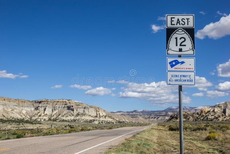
Dynamic management can also distribute visitation. Timed entry at especially constrained turnouts, reservations for high-demand parking areas, and temporary adjustments to access rules can prevent one scenic point from absorbing the day”s entire demand. Parking information can direct motorists toward less crowded vistas, nearby communities, or scheduled shuttle connections. These tools work best when paired with clear communication through destination websites, lodging partners, visitor centers, navigation platforms, and roadside signs.
| Management tool | Primary benefit | Planning consideration |
|---|---|---|
| Variable message signs | Provides early warnings and route choices | Messages must be timely, concise, and coordinated across agencies |
| Parking occupancy sensors | Reduces circulation caused by searching for spaces | Data systems require maintenance and public-facing updates |
| Timed-entry turnouts | Controls crowding at highly constrained viewpoints | Reservations should be simple and equitable for visitors |
| Shuttles and remote parking | Reduces vehicle pressure in sensitive locations | Operations need dependable funding and convenient connections |
| Wildlife detection signage | Improves driver awareness in collision zones | Signs should be supported by monitoring and enforcement |
California”s directory of federal and state transportation programs illustrates the range of available program categories, including intelligent transportation systems, innovative technologies, congestion reduction, resilience, emissions, safety, and wildlife crossings. While each state has its own eligibility rules, the broader lesson is useful: corridor managers should assemble a package of smaller, complementary interventions rather than assume that one major construction project is the only solution. A modest combination of real-time information, parking management, pedestrian improvements, and habitat design may protect scenic character more effectively than roadway expansion.
Funding and Interagency Governance for Long-Term Preservation
Scenic corridors rarely fit within one jurisdiction. A route may cross municipal boundaries, state lines, federal lands, tribal lands, and privately owned gateway properties. Different agencies may control pavement, parking, signs, vegetation, emergency response, visitor information, and conservation programs. Without a shared operating framework, one agency can unintentionally undermine another”s goals, such as promoting a peak-season event without accounting for limited road capacity or installing a turnout without a plan for pedestrian safety and habitat protection.
Federal support can help close that coordination gap. The Federal Highway Administration has reported that the National Scenic Byways Program funded 207 projects in 42 states with more than $22 million, supporting improvements such as scenic overlooks, visitor centers, pedestrian trails, bike paths, safety measures, and educational materials. Since 1992, the program had awarded more than $250 million for over 1,800 designated byway projects. These investments demonstrate that scenic preservation is compatible with transportation funding, provided projects connect access improvements to the qualities that make a route distinctive.
Local assistance, wildlife-crossing programs, congestion reduction funds, resilience grants, emergency preparedness resources, and tourism development allocations may also contribute to a corridor program. The most competitive proposals typically describe a complete visitor and community system rather than a stand-alone beautification project. They identify the transportation problem, explain the ecological risk, show how residents and businesses benefit, define measurable outcomes, and establish who will maintain the investment after construction.
- Define the shared corridor. Map the route, gateways, attractions, habitats, parking areas, communities, ownership patterns, and operational responsibilities. Agree on the visitor experience and natural resources the partnership is trying to protect.
- Create a common evidence base. Establish consistent measures for traffic, parking, crashes, wildlife collisions, erosion, visitor satisfaction, local business conditions, and emergency response. Shared data makes difficult policy discussions more objective.
- Assign decisions and funding. Specify which agency leads on signs, maintenance, enforcement, habitat work, visitor communication, and capital projects. Combine grants, transportation allocations, park budgets, tourism assessments, and local contributions where appropriate.
- Review performance each season. Publish or circulate an annual scorecard, evaluate what worked, and adjust thresholds, messages, mowing schedules, shuttle operations, or investment priorities before the next peak period.
Formal agreements can take the form of memoranda of understanding, intergovernmental agreements, corridor authorities, or standing working groups. The structure matters less than the commitments. Each partner should know how decisions will be made during an incident, who communicates with the public, how maintenance costs are shared, and how community concerns enter the process. Tourism boards can be especially valuable conveners because they understand visitor demand while maintaining relationships with lodging operators, attractions, chambers, and local businesses.
Governance should also include residents and frontline workers. A plan that improves the visitor view but lengthens employee commutes, blocks neighborhood access, or shifts parking into residential streets will not remain politically durable. Public meetings, business roundtables, multilingual information, and direct feedback channels can reveal operational realities that traffic models miss. Durable stewardship depends on treating the community as a partner in the visitor economy, not merely as the setting for it.
Building Resilient Scenic Corridors for the Next Generation of Travelers
Preservation and tourism viability are not opposing objectives. A healthy landscape is the core asset behind the scenic drive, while a well-managed visitor economy can generate the funding, political support, and public attention needed to protect that landscape. The strongest corridors therefore define success more broadly than vehicle counts. They measure whether visitors can move safely, whether residents retain reliable access, whether local businesses receive meaningful economic benefit, and whether wildlife, water, vegetation, and cultural resources remain intact.
Destination planners, park superintendents, transportation officials, and tourism leaders can begin with a practical commitment: manage the corridor as one connected visitor and ecological system. Start by sharing data, identifying the most urgent bottlenecks and habitat barriers, and agreeing on a small set of near-term actions. Then build toward smarter information systems, better roadside design, coordinated funding, and a standing interagency partnership. When communities make stewardship visible and operational, motorists receive a better experience, local businesses gain a more dependable tourism environment, and scenic byways remain worthy of the journey for generations to come.